
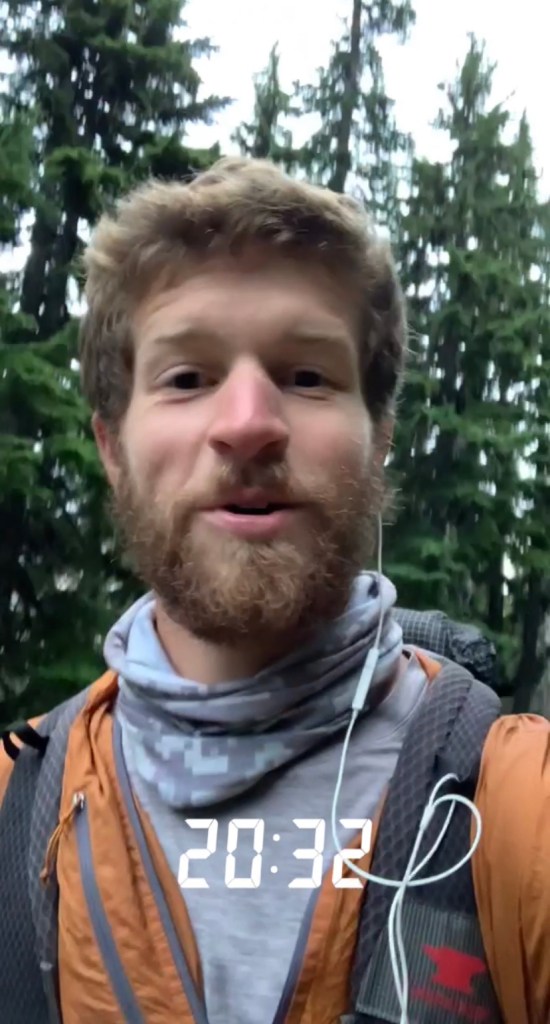
SEVENTY EIGHT – TUESDAY JULY 13, 2021

For a cheap five dollar spot I reaped all of the benefits of staying at Marine Park. There was no hiker box this early in the season but I watched sunrise over the Columbia River Gorge followed by a hot shower. About a month from now this park would host PCT Trail Days with thousands of hikers flooding the town of Cascade Locks. I experienced quite the opposite. I saw no other thru hikers as I wandered through town for breakfast, resupply, and charging. Noon came quickly and I found myself stuck in town for lunch. I decided I had spent enough time in Oregon and was ready for a new state.
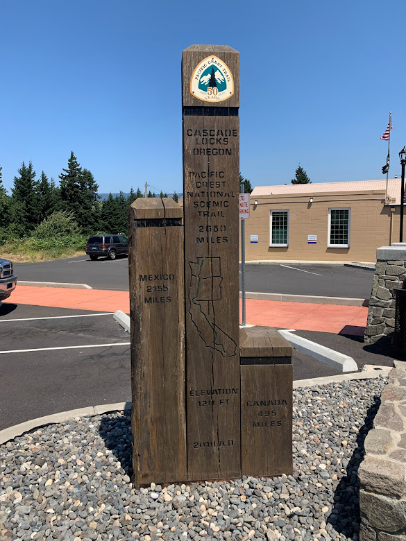
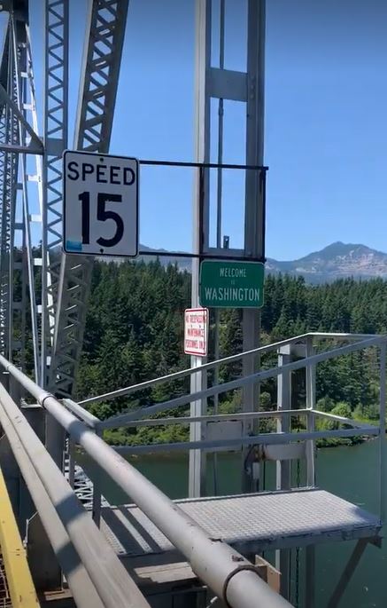
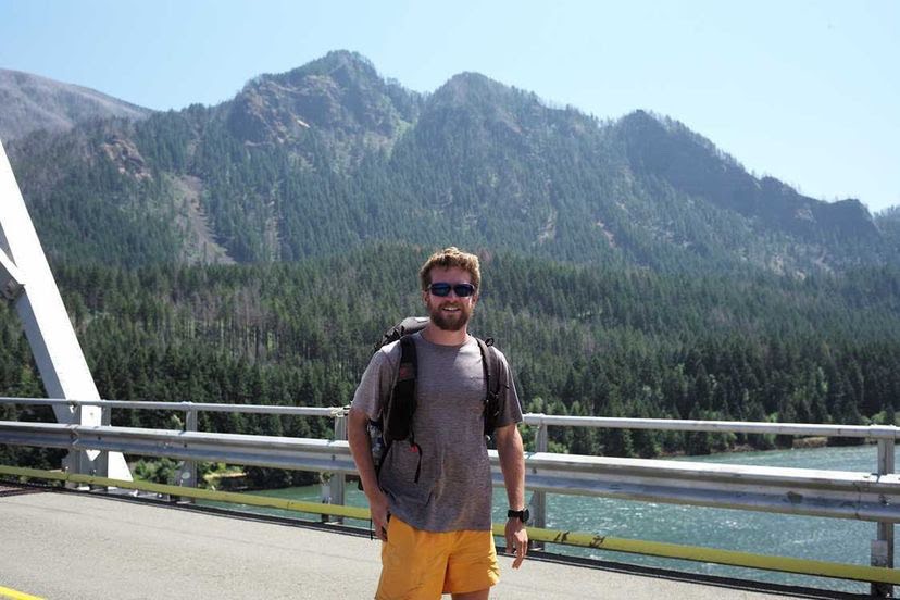
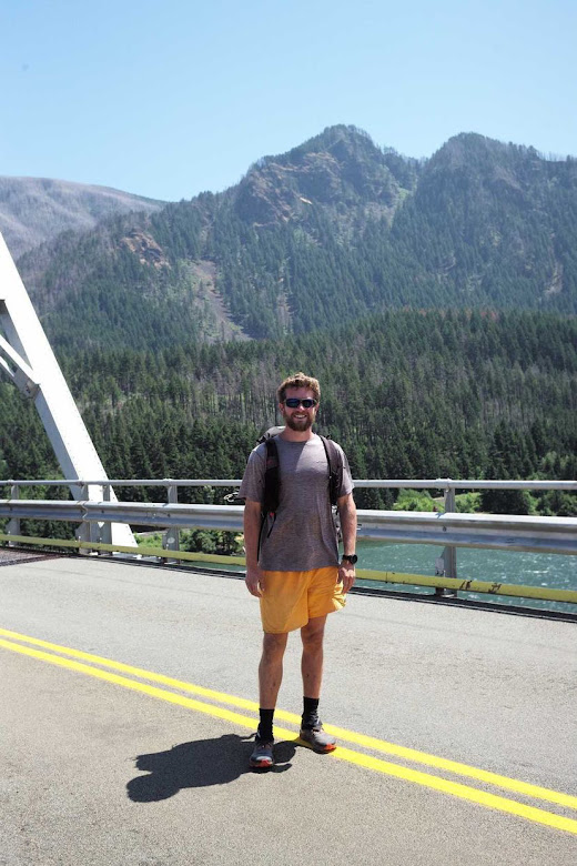
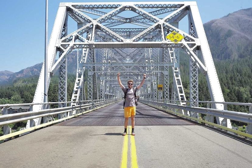
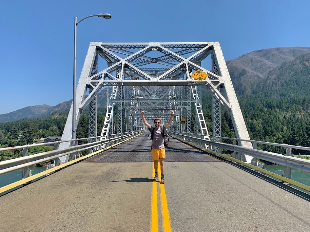
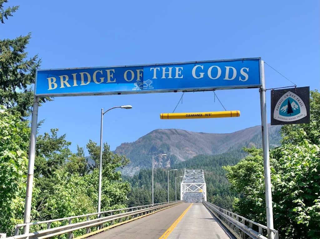
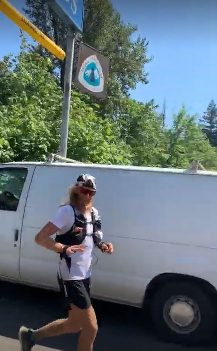
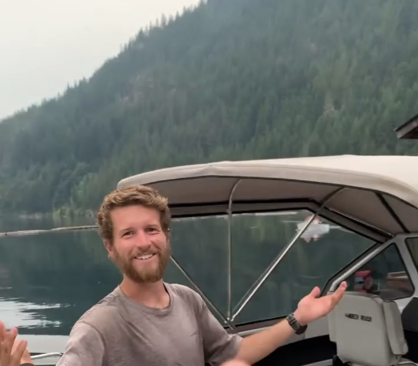
Washington! While approaching the Bridge of the Gods, the toll station attendant asked “are you the runner?”. I laughed hysterically, realizing she was looking for Tim Olson. Of course I could describe the physical feeling of walking across this bridge, which was nearly translucent with only perforated metal grating separating me from the river far below, but there was more of an emotional feeling. Crossing state lines felt like an accomplishment but I also realized Washington was my last state. I wanted to make the most of it with just over two weeks left on trail.
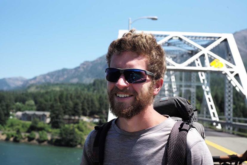
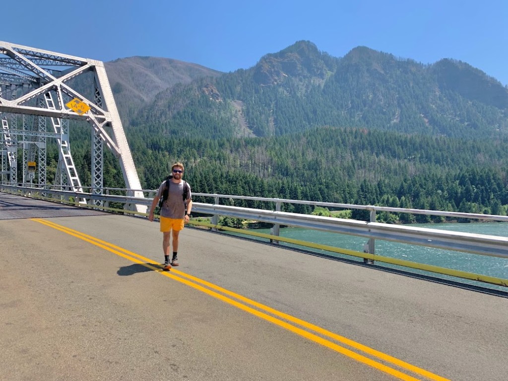
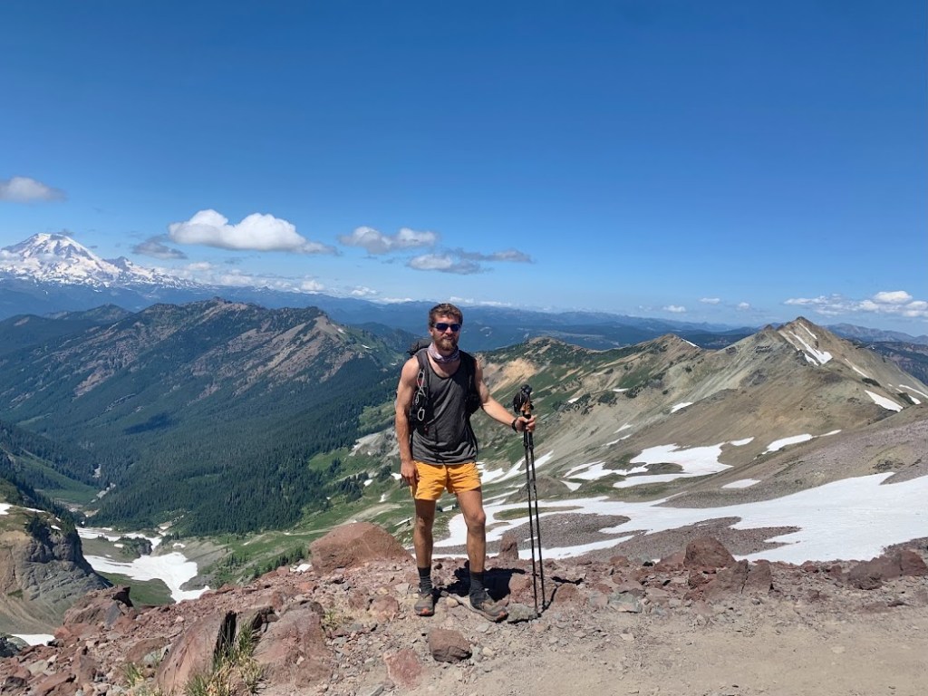
Near the other side of the bridge I saw a guy walking towards me and I asked if he would take my photo. Come to find this guy Dave was a professional photographer out on assignment for Tim Olson’s FKT. I definitely approached the correct stranger. He used my phone and also his film camera. Below are too many photos of me that you didn’t ask for.


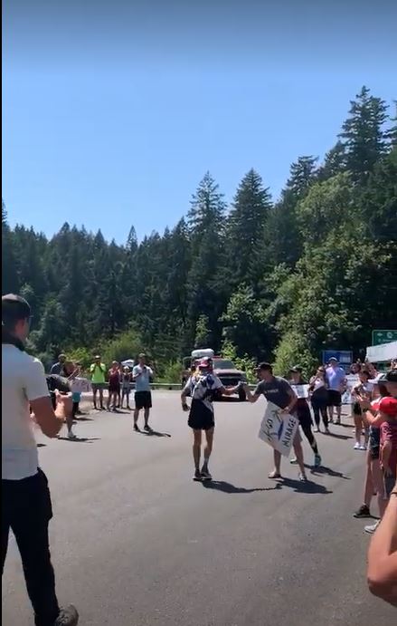
There was a small crowd gathered in Washington. No, they were not there for me. If the toll attendant wasn’t enough of a hint, I heard one of the spectators say Tim should be crossing the bridge in the next hour. I had already wasted my morning so I might as well see him cross this major landmark. While hanging around I did get recognized though. Two sisters and their kids were roadtripping around and remembered passing by and talking to me a couple of days earlier at Timberline Lodge.
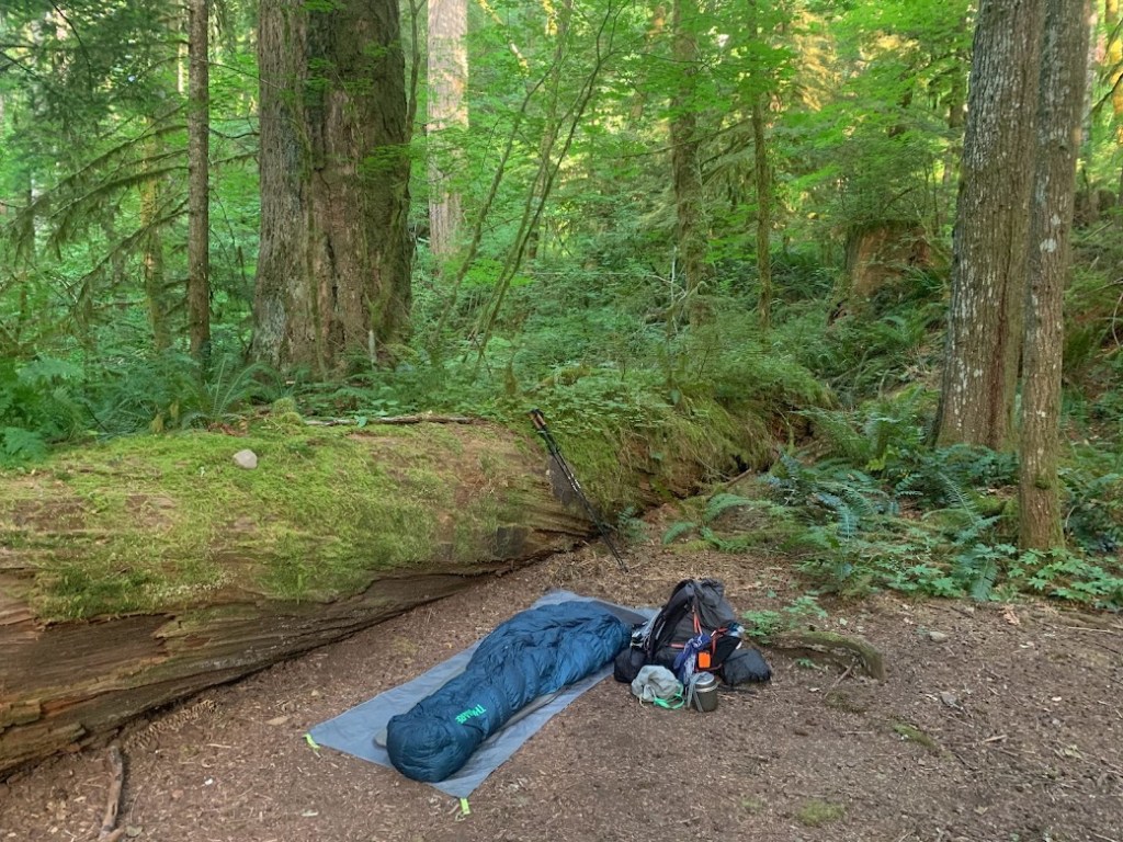
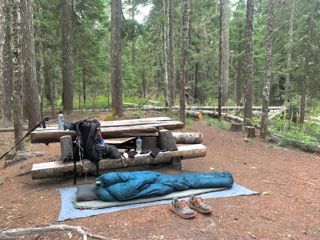
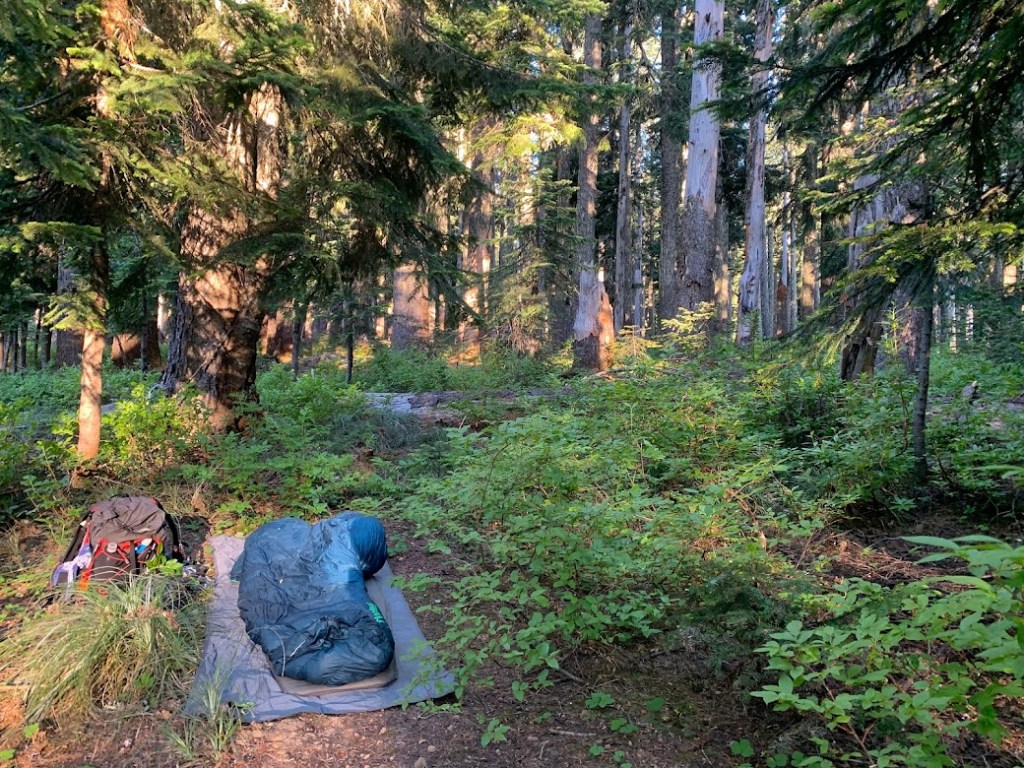
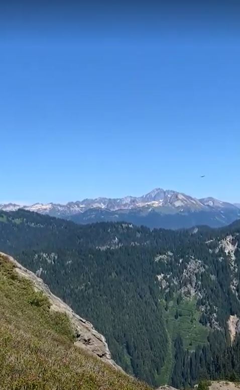
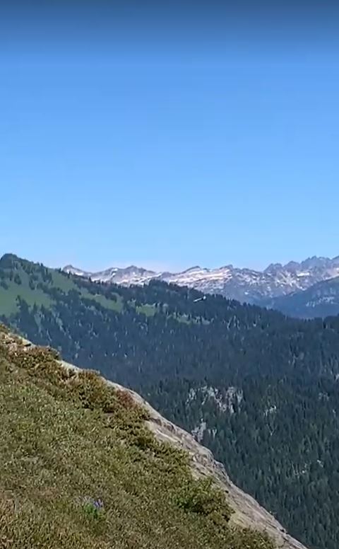
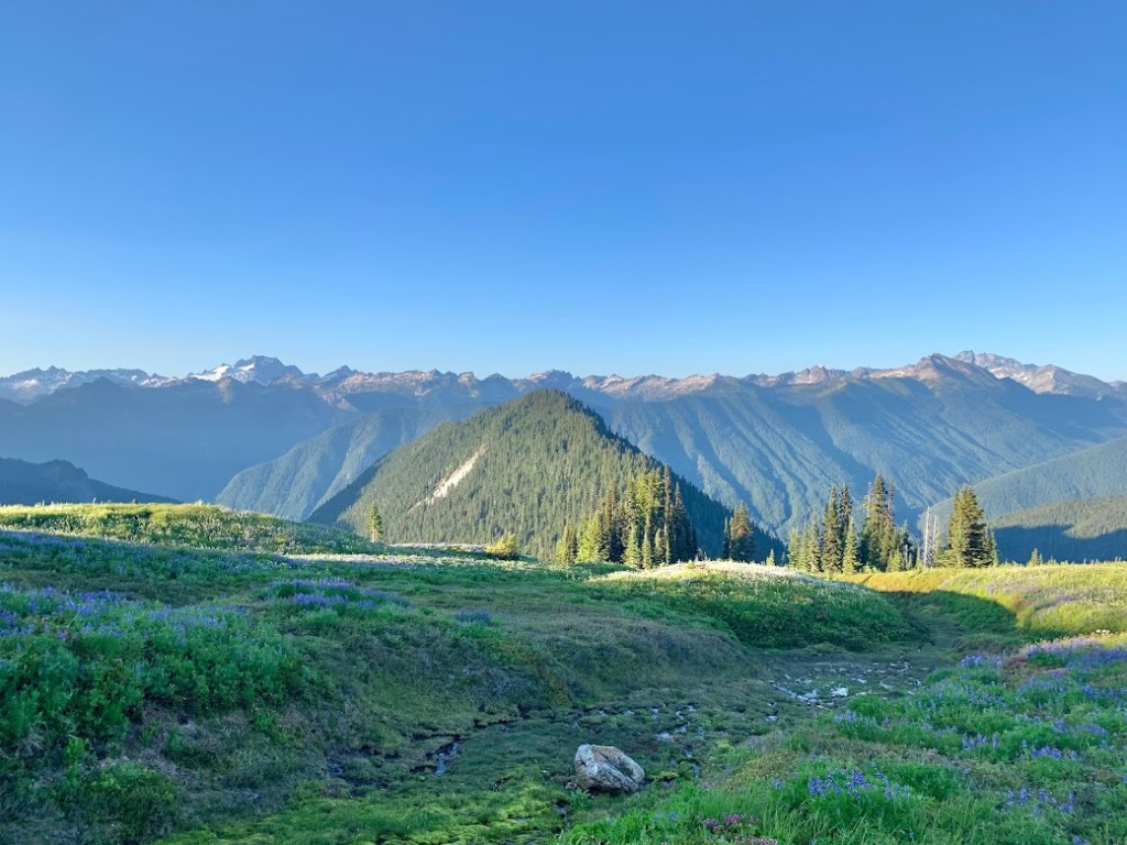
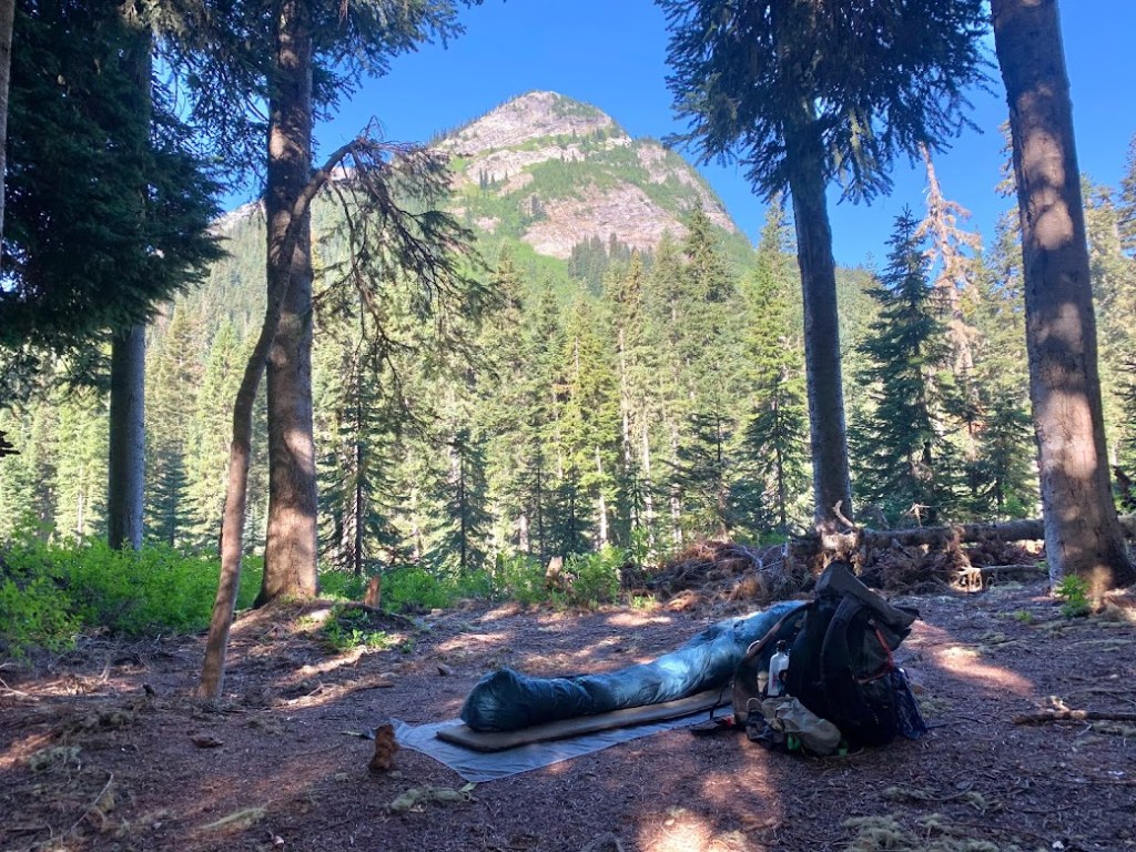
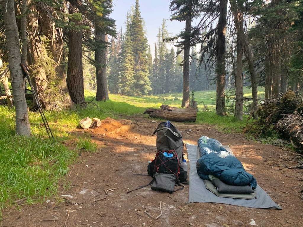
Once Tim passed I followed suit and headed north. There was a good amount of climbing but I was mesmerized by the trees of Washington. They were old growth towering high up, covered in moss, and looked like they belonged in a painting. I strived for my short day twenty mile goal and curled up next to one of those large trees that had fallen.


SEVENTY NINE – WEDNESDAY JULY 14, 2021
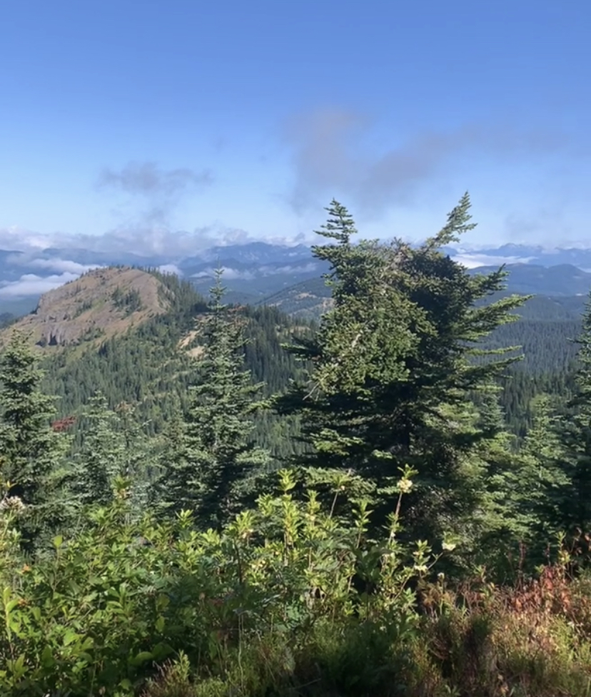
All day I was underneath the canopy with ferns scattered alongside the trail. There were several bridges crossing over creeks and rivers, creating plenty of opportunities to stop. I wanted to have a better day than yesterday but I eventually stopped at the Panther Creek bridge to dunk my head and refill water. There I met “Brom” from Belgium who was doing a section hike. I refer to him as “Belgium Brom”. He was a cool dude and we shared some stories over water. A few hours before sunset I passed a spot with my first clear view looking ahead at Mount Adams. This would have been the perfect place to stop if it were a few miles further.

I pushed into the night to make it to Crest Camp. This was the first access to Trout Lake via NF-60. I saw no sign of life so I was not hopeful for a hitch. It had only been two days since the last town so I did not need to get off trail anyway.
EIGHTY – THURSDAY JULY 15, 2021
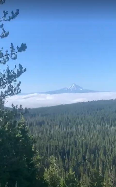
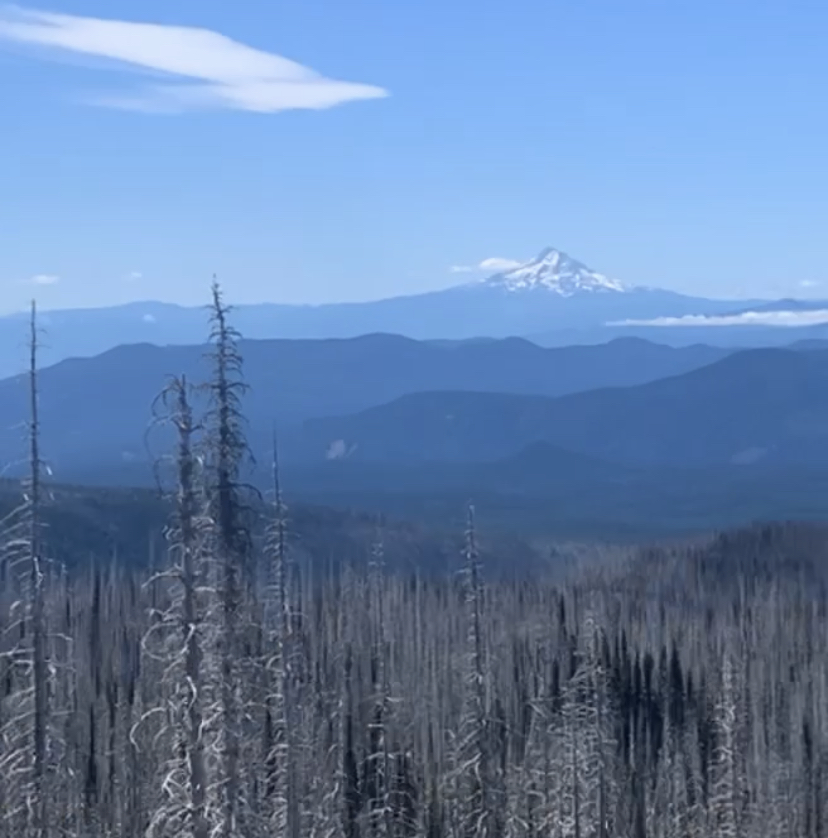
There were still no others this morning so I decided to push on. It was at least sixteen miles to the next road, so I would not be enjoying a hot breakfast. I was rewarded with a view back at Mount Hood, from right in the middle of Indian Heaven Wilderness.
By early afternoon I reached the first road at NF-24. It was a gravel road with nobody around so I pushed another hour to Big Mosquito Lake where there was pavement. After about an hour of zero traffic, a truck stopped for me. They were out crewing their son Bob who was an avid section hiker. It would be a while until Bob showed up so they gladly gave me a ride into town.
I checked in at the general store where they had a solid selection. Down the street at Station Cafe I got a burger and a beer before returning to the general store for my resupply. On the front porch I met Gerry. He was a trail angel who used to work for the Forest Service. I was early in the season before the scheduled shuttle service was running and I was needing a ride to the uncommon access point but Gerry made a special trip to take me back to the trail.
I hiked a few hours passing several dirt roads and after dark I passed the last access to Trout Lake at NF-23. At the next creek crossing I decided to call it a day. After several hours in town I was still able to pull off a thirty two mile day.
EIGHTY ONE – FRIDAY JULY 16, 2021
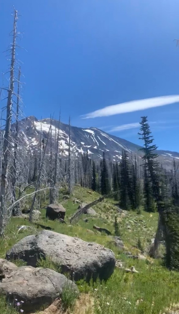
I spent the morning approaching the next volcano. By early afternoon I was traversing around the base of Mount Adams with views of Rainier ahead and Hood back in the distance. There were several creeks running off its glaciers, most of which were not accompanied by a footbridge.

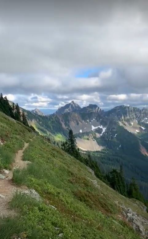
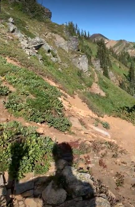
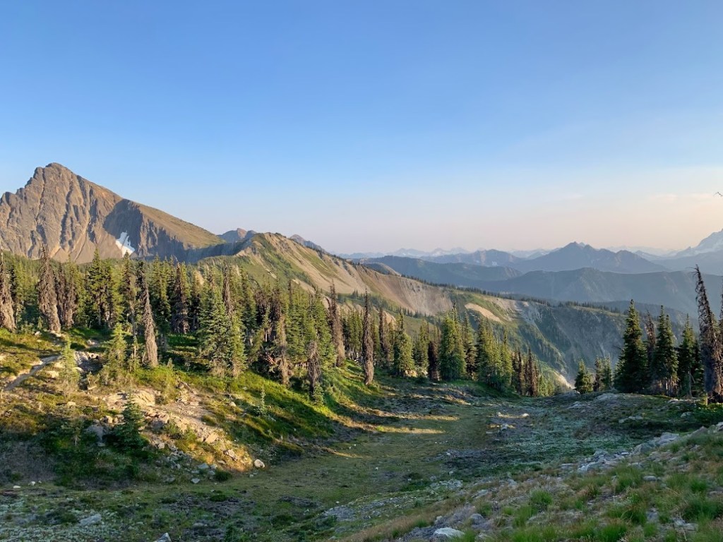
In the late afternoon I finally reached the area I had heard so much about. Goat Rocks Wilderness. It was revered as one of the best sections of trail. These first few hours did not convince me of that. I felt like I was back in Oregon under tree cover and swallowed by mosquitoes. I pushed over thirty miles to set myself up for a chance at town the next night.

EIGHTY TWO – SATURDAY JULY 17, 2021
After emerging from the canopy the trail began to wrap around a valley above the Klickitat River. This was a beautiful section and better than the day before but I was still not convinced.


As I approached Cispus Pass I saw someone coming towards me. This was my first southbounder, “Blueprint”! He seemed to be very casual, not entirely aware that he was at the front of the pack, wearing lots of blue and some gas station sunglasses. I decided to take a short break at the top of the pass and there I met “Manuel from Montreal”. The SOBO seal had been broken. From here on for the next two weeks I would see more Southbounders than I would Northbounders.
The view kept getting better. I now felt like I was in a movie, working towards the climax. I stopped to turn around for a view of Mount Adams and asked a day hiker for a photo.

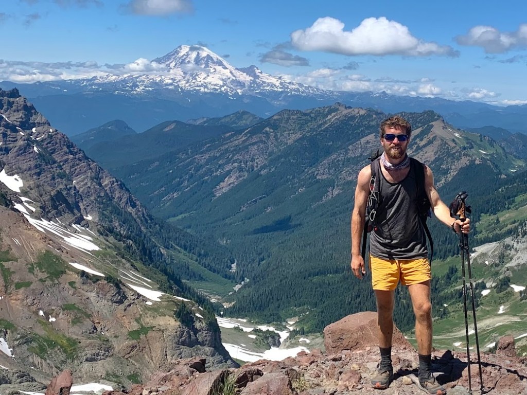
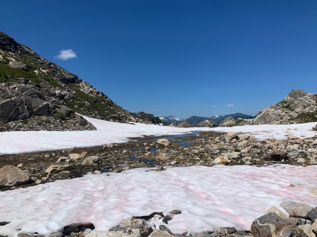
This was a low snow year but I soon hit the pack line. I had my first unobstructed view of Mount Rainier and stopped for another photo.
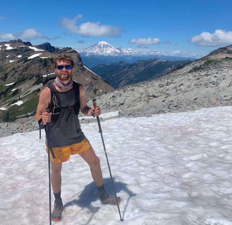
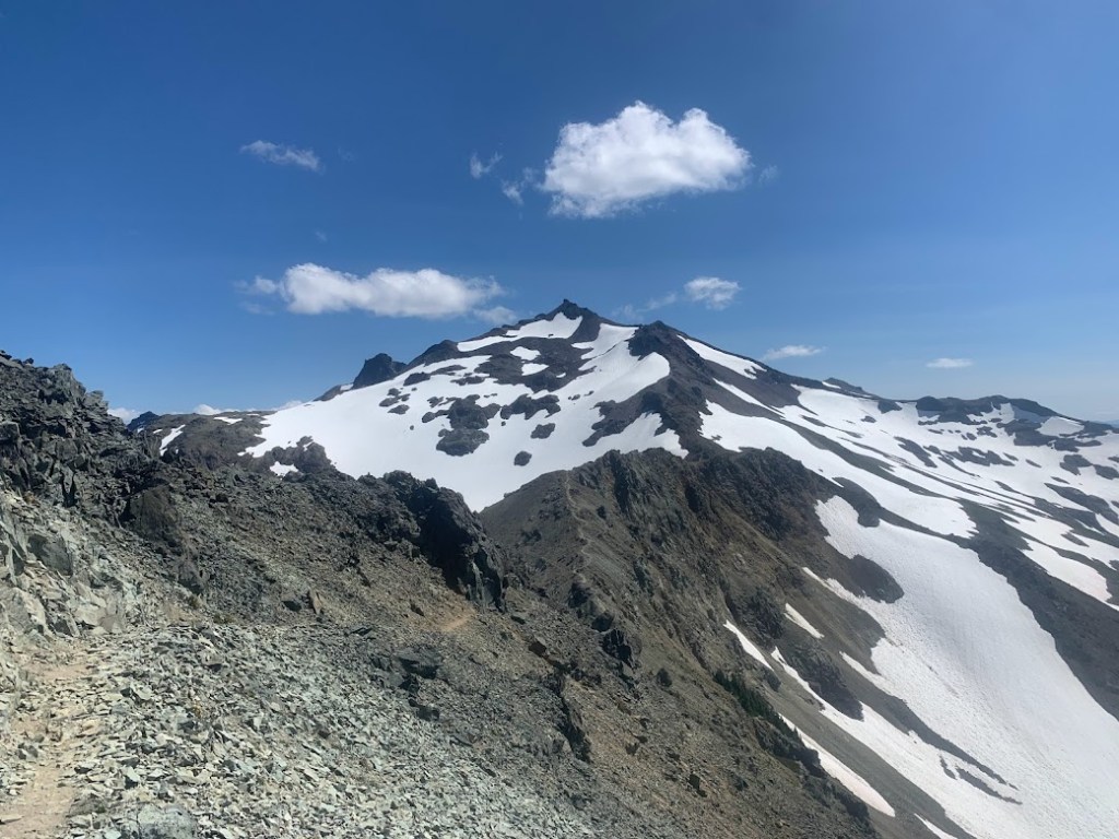
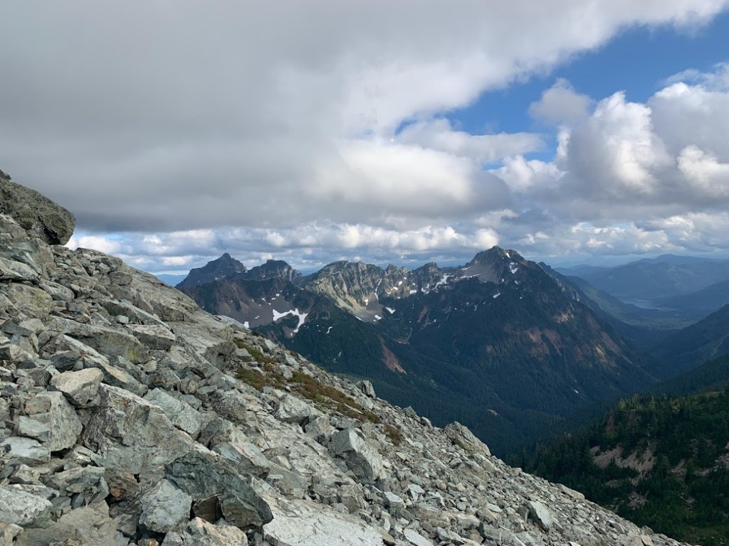
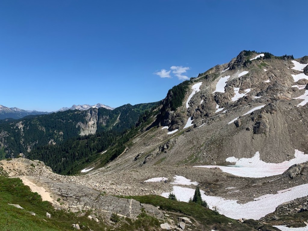
This was the base of Old Snowy Mountain I was traversing. A popular short alternate is to travel around the other side of the peak and come down the Knife’s Edge on the north face. This early in the season I did not have any good information nor any of my snow gear, so I stuck to the main route and took a break at the other end. There was a nice group of day hikers hanging out that gave me some food and insisted I take a few more pictures. I am so glad they did. You can never have enough photos.
I continued on down the bottom of the Knife’s Edge and then ran for a few miles. I even saw a herd of goats in the distance. As the sun began to set I was still running along the side of Hogback Mountain. This was some prime running right here.

I made it to the road just before dark and threw out my hopeful thumb. I waited for about an hour with only a couple of cars passing by. The brewery in Packwood was about to close anyway, so I walked over to the Kracker Barrel and decided to stay here for the night. I found a mechanical closet on the side of the building that had a spare outlet, so I plugged in and set up a cowboy spot in the back.
EIGHTY THREE – SUNDAY JULY 18, 2021

There was a tent set up next to me. I probably woke up “Baywatch” and “Hobo Baggins” last night but they were a couple of friendly section hikers this morning. Once the store opened up we rushed inside and set up camp in the lounge. The Kracker Barrel had all amenities including hot food, resupply, laundry, and showers. I decided not to go to Packwood while enticed by the tab they were letting me run up here.
In the hiker box I found a jar of Biscoff cookie butter. In towns I had been eating as much as humanly possible but it was not enough to keep up with what I was burning between. I figured this would be a good source of fat on trail. You would think the taste would be so rich but my taste buds had expanded their tolerance limits to the point that I could eat this by the spoonful.
After showering and while waiting on laundry I decided to kill some time. What did I normally do to kill time in town? Eat, of course. I got a pizza from across the street and finished half of it on the walk back. I jokingly told the other hikers that they only sold me half of a pizza. The funny part is this was not more than a 100 yard walk. After a couple “one more hour” delays I had to head back out. Yes, it was going to be one of those twenty mile days.
Leaving the trailhead parking lot I saw a familiar sight. A large group of day hikers were heading back to their cars. They warned me of the mosquitoes ahead and I laughed with reassurance the worst was behind me in Oregon. The next ten miles were indeed pretty rough, passing by small stagnant skeeter infested ponds reminiscent of the state whose name we shall not say again. I did end up making my twenty miles and stopped just outside of Mount Rainier National Park.
EIGHTY FOUR – MONDAY JULY 19, 2021
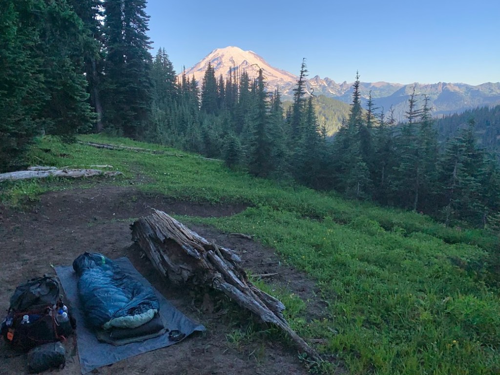
I woke up to my first clear and up close view of Mount Rainier. This was one of my best and maybe the best campsite the whole trail. I sat there and enjoyed the moment while the sun rose. A southbounder breezed by and was impressed by this spot. That was my cue to hit the trail. Soon after I started walking I saw another southbounder heading toward me. He pulled off to the side and stood straight looking like he was about to atten-hut. He yelled at the top of his lungs as if he were announcing royalty entering “The First NOBO of the Day!”. I immediately started laughing, thanked him for the gesture, and of course told him to have a good hike. That encounter stuck in my head for the rest of the day and really the rest of my hike. I wonder how many days he kept that up and how many exhausted northbounder spirits he lifted.
Rainier stayed in sight most of the day. This section reminded me of the couple of days circumnavigating Shasta but this had a more intimate setting with a shorter radius. The peace was interrupted as I approached Chinook Pass at the Highway 410 crossing. It was the middle of summer and this place was crawling with tourists. The bustle of cars and the pedestrian bridge that read “Mount Rainier National Park” signified I was indeed in a popular destination. The pit toilet was nice but nothing magical here so I headed back on the trail. Just a few miles ahead at Sourdough Gap I found phone service and decided to take a break. Here I met “Second” and “Happy Dance”. I think they were doing a SOBO LASH.


To make up for my twenty mile day yesterday I pushed thirty seven with all I had. By this time of the night I was exhausted but there were no flat spots in sight. I crossed a dirt road and decided to walk up it until I found something level.
EIGHTY FIVE – TUESDAY JULY 20, 2021
I had one goal today. Make it to Snoqualmie Pass. Of course I took my Campsite Collection photo to start the day but only took one more photo and one video. Other than that I was grooving along and crushing miles. I did not even run any miles today but instead focused on the task at hand.
After midnight I could see the lights of what seemed to be a bustling city. In reality it was your average interstate truck stop but it was more than that to me. This was my second longest day on the entire trail. Forty one miles and this time I was traversing high mountains and did not have someone pacing me along. The last half mile I scooted down ski lift roads and hit the pavement. Everything seemed to be shut down but luckily the Summit Inn desk was open all night. By this point it was 1 AM. I was able to secure a room, took a quick shower, and slept like a baby.
EIGHTY SIX – WEDNESDAY JULY 21, 2021
I woke up and instead of snoozing in the bed I figured I should get my town chores out of the way. First I checked in at the front desk to pick up my resupply box. I was delighted to find a surprise resupply box from my good friends Cutler and Rachael.

After breakfast I continued with my town errands. There was not a grocery store but two market/convenience stores so I decided to hit up both. After walking out of the second store I did a double take on who passed by. “Rugby??” I had not seen him since the Sierra. He told me that he had jumped ahead on the trail and for personal reasons he was ending his hike here and heading back home to California. I saw him again at the Summit and we exchanged info before I headed out for the trail. This morning was cloudy, misty, windy, and chilly but it looked like the sun might come out eventually. Since I got in so late last night I decided to use every bit of my hotel time and rest until the 11 AM checkout.
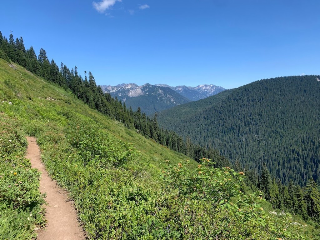
The sun was still hiding but that steep climb out of Snoqualmie was more than enough to warm up. The view kept getting better and better as I climbed upward. These mountains were something else. I was in the Wenatchee Mountains right in the middle of the Cascades. Later I heard from another hiker that this section had the most elevation gain per mile. That I agree with.


In my golden hour jaunt I passed by a SOBO. He looked surprised to see me but I was sure he had seen the dozen hikers ahead of me. He stopped for a moment and said “Wow I didn’t know anyone else hiked this late.”. I laughed and told him to have a good hike. He may not have noticed but I had a seasoned laugh, recounting all of the nights I hiked into darkness and until midnight or later. He was young and had been on trail for about a week. I on the other hand was numb to the night. Once I reached the twenty mile minimum I stopped for the night at Lemah Creek.
EIGHTY SEVEN – THURSDAY JULY 22, 2021
Even after a long town rest yesterday I woke up exhausted. It was not until 9 AM that I started hiking. The afternoon climbs took a toll on me and my body was just fatigued. With one week left I knew I could push through it. After a big morning climb I was rewarded with sweeping views of Waptus Lake below.


I started to climb again alongside Spinola Creek, mostly under tree cover. I could barely see through but a low flying fighter jet flew right above me. That made the remote feeling set in, but soon after I approached a group of PCTA trail work volunteers. I was amazed at how far out here they lugged their tools. On the other side of that climb and after a somewhat decent day I stopped near a small creek crossing.
EIGHTY EIGHT – FRIDAY JULY 23, 2021

This was one of those mistakenly good campsites that I woke up in. I had an excellent view of Cathedral Rock.
In the early afternoon I passed by Glacier and Surprise Lakes before climbing up to Traps Pass. There was a good view of Trap Lake, which looked like it was dammed up with its creek valley flowing below and beyond. I ran the next few miles until the trail began to climb again.

As I was approaching Stevens Pass I saw something familiar walking toward me. It was my pack! The Mountainsmith ZERK 40. In nearly three months on trail the packs consisted of Hyperlite, Gossamer Gear, Osprey, etc. Of course I stopped to talk to him and was astonished by his Estonian accent. Less than a mile later I met Marvel who looked like she was crushing some miles. With four miles to Stevens Pass I approached some powerlines and ski lifts which made me feel close.
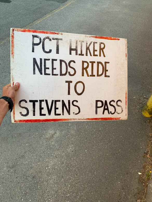
This was a busy highway crossing but it was so fast that cars did not want to stop. Eventually a minivan pulled over. A father and son were out doing a long road trip and living a semi vanlife. They drove me down from the pass and around the whole three blocks of Skykomish and dropped me at LouSki’s Deli. I remember they were pulling away but circled back around for the son to hand me a big bag of trail mix with a big smile on his face. I definitely felt like a homeless person but could not have been more grateful. At the deli I ordered a big sandwich and some drinks before walking across the street for a gas station resupply. I knew I had over 100 miles to Stehekin which made me scour the shelves for all they had. The last few days felt as or more difficult than the Sierra and here I was again having to resupply at a gas station like I did in Independence and Bishop. The cafe had a sign hanging in their window that they let hikers use for a hitch.
“Bey” was visiting from across the border and stopped to pick me up. She hike the trail a few years ago and was also heading to Stehekin to see some friends. I knew my feet were not as fast as her car but she said to look for me while I was there. I hiked a few more miles as the sun was setting, just far enough away from the highway noise.
EIGHTY NINE – SATURDAY JULY 24, 2021
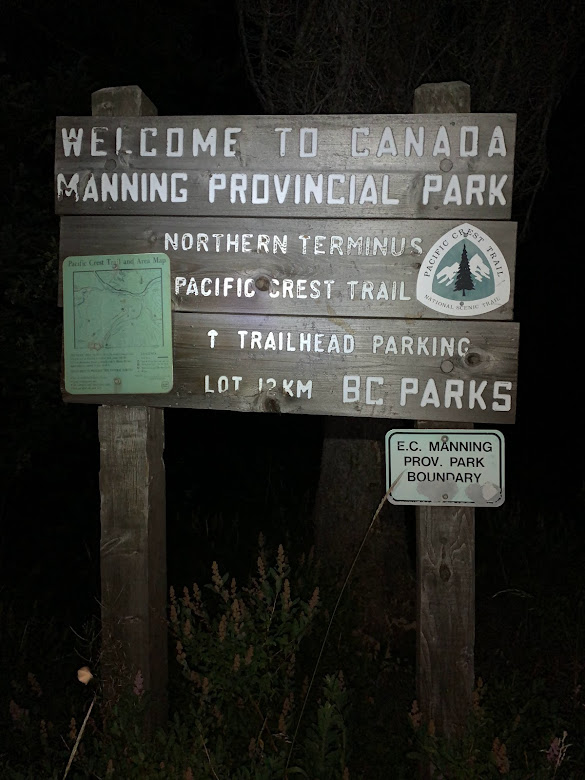
I had service for a few hours and realized this may be my last good chance to arrange my exit plan. In normal years many hikers will reach the Canadian border and continue onward through Manning Provincial Park. From the northern terminus this is only a five mile hike into Canada to the nearest road. The border was still closed from 2020 and I knew that ahead of time. Halfway through the trail I had developed a plan to have my family pick me up the day after my finish. This meant I would need to reach the border and then turn around to backtrack south for thirty miles to Hart’s Pass. This was Option B.
What I did not prepare for was the wildfire that started in the area about a week before my approach. On the trail there was not much phone service so my main source of news was often by word of mouth. There were few hikers north of me but by this time of year there were southbound hikers that started at Canada and headed toward Mexico. I heard of the first few northbound hikers who finished the trail and were able to exit via Hart’s Pass, but all of the southbound hikers I met had taken a different route.
With the border closed to the north and a wildfire to the east, only the west remained. The Pacific Northwest Trail (PNWT). This was my Option C. Instead of backtracking thirty miles south, there was a trail junction seventeen miles south with the east-west oriented PNWT. I would take this trail west for nineteen miles, a total of thirty six miles from the Canadian border. At the end of this section of the Pacific Northwest Trail was not a road but simply a lake shore. Ironically before I had even begun hiking months ago I had researched this area and thought I might do some section hiking of the Pacific Northwest Trail after reaching Canada. I went so far as to find there was a backcountry water taxi that operated there on Ross Lake. Months later in this panicked moment of disaster rerouting I remembered my research and had also heard some of the southbounders utilized the service. So, before I continued on much further today I called the marina and scheduled the water taxi to pick me up the day after my finish at noon, exactly a week from today. The clock was officially ticking.
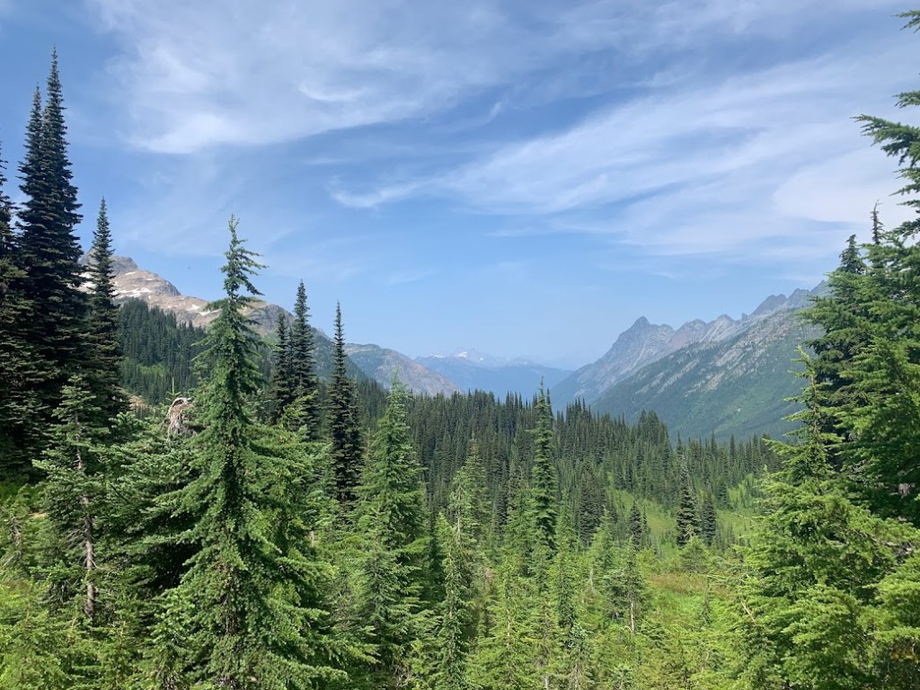
I had entered the south end of the North Cascades and after climbing over Grizzly Peak had an excellent view approaching Glacier Peak. I could also see a volcanic peak silhouette way off in the distance, maybe Mount Baker.


I do not remember seeing many people but did have an odd animal encounter. Right next to the trail was a deer that froze in its tracks. We were less than ten feet apart, both still. I decided to bow my head and to my surprise it bowed right back. I was in shock and felt a connection to this animal. We both had to keep going and parted ways.
After a day of great views and wild nature I did not make much progress. These mountains were even more brutal than the Wenatchee. I stopped and set up right along Pass Creek. There were a few weekend hikers here and also another north Washington rarity. A backcountry pit toilet. The funny thing about these pit toilets is there were no walls. It was literally just a pit, but that was good enough for me.
NINETY – SUNDAY JULY 25, 2021
I had another late start, so late that the sun was beating on my tent and its heat forced me to emerge. I did not start hiking until 10 AM and knew it would take me four days, not three, to hike to Stehekin. The morning was spent climbing, but the afternoon was full of ridgeline views between Indian Pass, White Pass, and Red Pass.


For a second day in a row I had another odd animal encounter. There was a marmot right next to the trail that stopped me. He was standing looking at me and I decided to crouch down to his level. He dropped down to his belly and stared back as curious as I was. At this point I felt more animal than man. My miles were showing.
In late afternoon I crossed one of the most scenic bridges in Washington across the White Chuck River. This glacial water was flowing from the White Chuck Glacier just upstream.

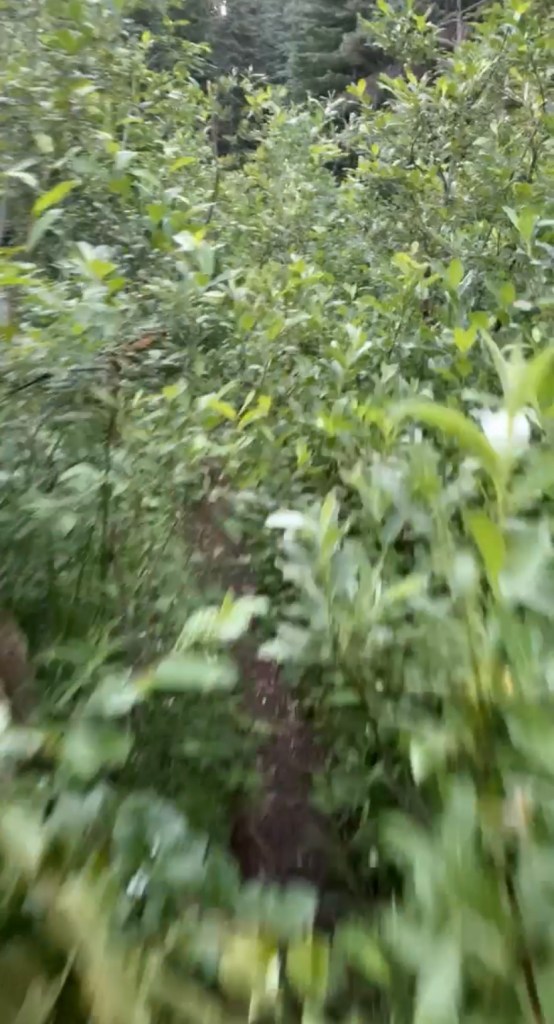
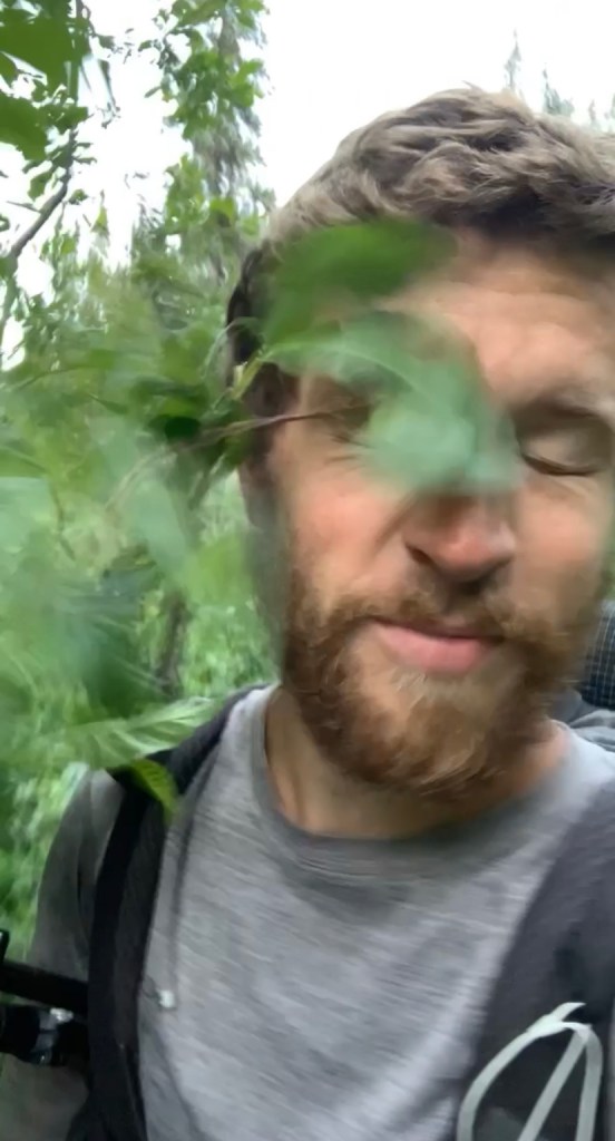
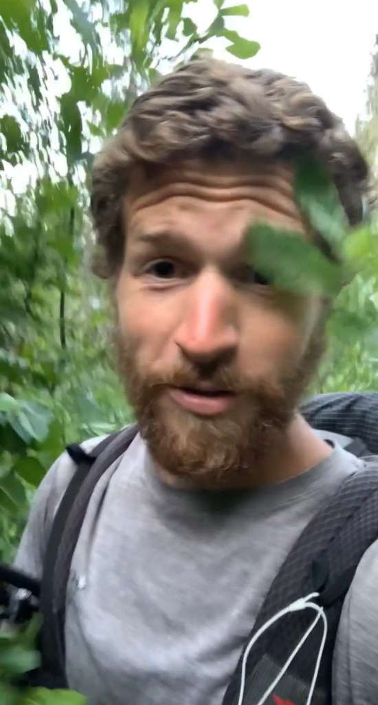
With a day full of views both high and low something had to give. The river valley soon became overgrown and I was constantly being smacked in the face by branches. I never thought I would wish such a thing but at this point I would rather be climbing, out of the brush. Around the north face of Glacier Peak I found a spot to stop.
NINETY ONE – MONDAY JULY 26, 2021

Another Washington morning meant a climb right away. For the first few hours I headed straight north away from Glacier Peak and found myself on a ridge between Mica and Milk Lakes. There was a southbound group here taking a lunch break. I stopped to talk for a minute and then made my way down the other side. Right after I left that group I started to run the next five miles into the Milk Creek valley when another low flying fighter jet passed by. This time I was out of the trees and had plenty of heads up to get a video.

The next few miles of climbing were hot, overgrown, dry, and reminded me of north California. I crested the top of another ridge and was officially completing the Glacier Peak tour. With a look ahead on the map it seemed like it would be smooth valley sailing to Stehekin. I only had a couple more hours of daylight and at least nine miles to hit my daily average. I ran the next six miles down to the Suiattle River and then hiked another hour or so in the dark. By this point I was exhausted but was not finding any flat spots. I set up a cowboy not two feet from the edge of the trail. I feared an early morning hiker accidentally stabbing me with their trekking pole but that was tomorrow’s problem.
NINETY TWO – TUESDAY JULY 27, 2021

I woke up with no stabbings. All was well and it was not a typical Washington morning. I spent the first few hours along the Suiattle River and then along MIner’s Creek with climbing at a minimum. Of course there had to be one big climb for the day up Suiattle Pass, but the other side was another valley tromp along Agnes Creek.
In mid afternoon I stopped for a refill and was so exhausted I decided to sit straight on the dirt while filtering my water. I was startled by an approaching SOBO and looked up to see what appeared to be an angel. She had a French Canadian accent, was illuminated by the sun through the trees, and for some reason was talking to me. She asked about my journey thus far and congratulated me on my near completion. We did not exchange names and I still think it may have been a hallucination.
With mostly easy terrain I was confident I would make it to Stehekin with about thirty miles for the day. However, the closer I got to the road the more downed trees I was having to climb over. These trees were so tall that it was easier to go over them than around them. The diameter was so large that I was able to grip the bark on these old growth trees and use all four limbs to make it over. A couple of hours into the night I finally made it to the road. I was unable to find the backpacker site and there was absolutely zero traffic, so I set up a cowboy near the bridge.
NINETY THREE – WEDNESDAY JULY 28, 2021
This morning reminded me of the weather in Snoqualmie, maybe even colder. I woke up around sunrise but still had a few hours until the famous “Red Bus” would pick me up in transit to Stehekin. This valley did not get much sunlight but eventually I found a break in the trees where a small ray was peeking through.
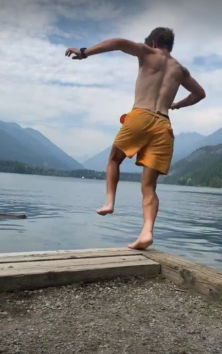
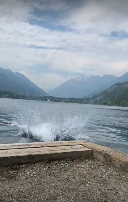
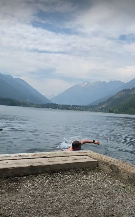
Finally 9 AM rolled around and the bus pulled up. Out of the woodworks came two other hikers just in time. On the bus I got to talking with Abbie & Elle. I assumed they were SOBO with lack of trail names or battle scars. They told me their plan to SOBO LASH Washington and Oregon and then bikepack the California coast. Halfway through the bus ride we stopped at the famous Stehekin Pastry Company. I grabbed something to go and hopped back on the bus to head to the North Cascades Lodge. Underneath the deck of the main building were picnic tables, kind of designated for hikers. Abbie, Elle, and I devoured some baked goods and we also met “Roadside”. He had a tattered Pacific Crest Trail logo hat and I think he was wearing one of those long sleeve button down fishing/desert shirts, which was also in pretty rough shape. He looked like the typical PCT hiker who had been on trail for a few months and at the end of his journey. The miles were reflected in his face. If there were any mirrors nearby I would be able to see another looking the same. Here I resupplied food at the general store and also scrounged through the hiker box near the post office. I enjoyed my last town meal at the restaurant with the typical burger, fries, and beer. With about an hour left in the village I decided to go for a swim in Lake Chelan. It had been about a week since I showered so this would hold me over for a few more days.
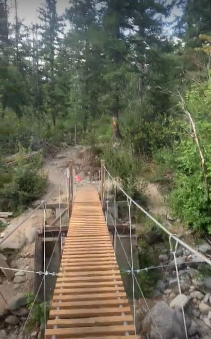
On the Red Bus we stopped at the bakery again. This was my last PCT resupply so might as well run in. I grabbed a couple of slices of pizza and a ginormous cinnamon roll. Once I was back on trail I passed a group of college kids and one of them asked if I was a thru hiker. I told him yep and kept cruising by, almost like a scene in a movie or a mic drop. I then came to a river crossing where it looked like the old bridge washed away. Ironically this was Bridge Creek. In its place was a temporary bridge built of cables, PVC, and wooden slats that were distantly spaced. It was pretty sketchy but it worked. I then began to climb up from the river and passed by Eric & Anya who were out for a SOBO section.

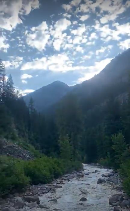
That afternoon I made it to Rainy Pass, less than sixty five miles from Canada. Normally hikers will hitch a ride here and travel 10 miles to Mazama before their final push. Did I mention there was a wildfire? The highway was closed east of here and cut off access to town. There were no reasonable resupply options west of here but I had planned ahead and overstocked in Stehekin (hence the cinnamon roll). There must have been thirty cars in the parking lot but no people to be seen. I set up in the flat spot behind the restroom and passed out.
NINETY FOUR – THURSDAY JULY 29, 2021
I had a little over sixty miles to the border and knew today needed to be a big day. I leaned over in my sleeping bag and ate my packed out cinnamon roll in bed to shock the system with some sugar. It was off to the races.
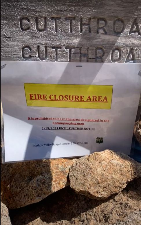
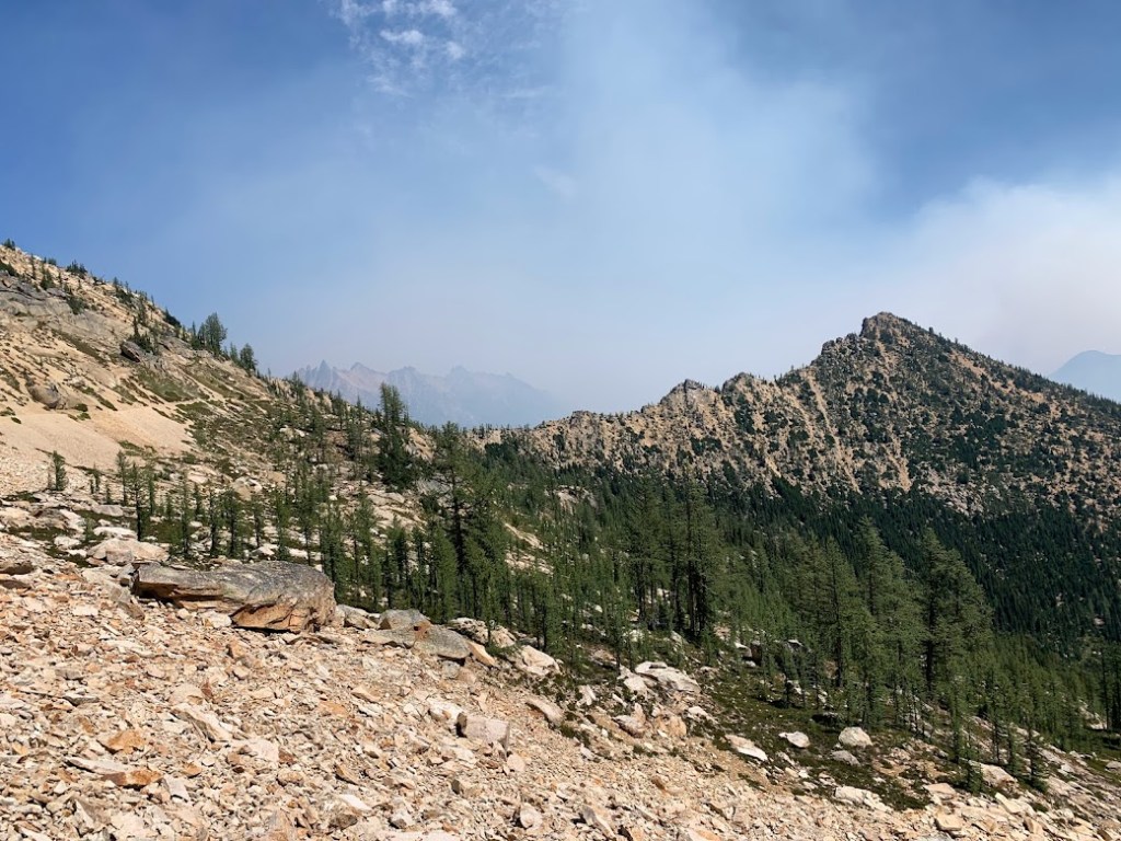
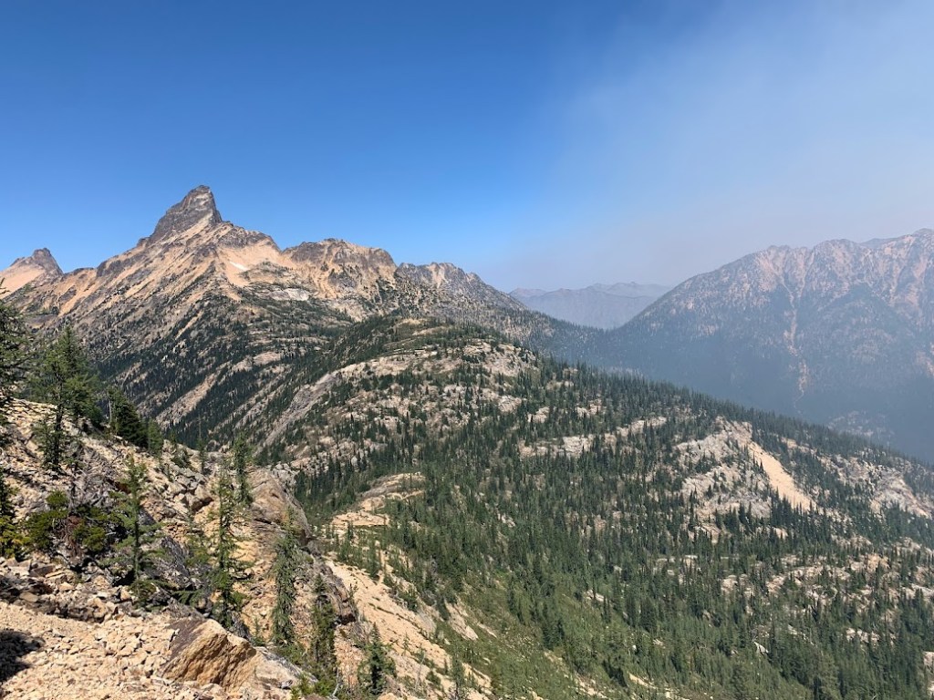
Right at noon I found the border of the wildfire closure at Cutthroat Pass. I was hiking on the edge of the large smoke clouds. In addition to the steep climbs and sun exposure, the slight inhalation of smoke was not conducive to a productive day. I made it twenty nine miles but fell just short of my goal at Hart’s Pass.


NINETY FIVE – FRIDAY JULY 30, 2021

I woke up on July 30th and it felt like Christmas. This was my 95th and final day of the Pacific Crest Trail. Oh yeah… It was also my birthday. The entire summer I was pushing myself to finish on my birthday and it had finally (almost) come to fruition. But there was something funky in the air. No, not the wildfire smoke. Normally on my birthday I would be receiving phone calls and messages from friends and family wishing me well. I had absolutely zero service. And that was a daunting yet refreshing feeling. Think about the last time you spent the whole day by yourself in peace. I heard two hikers pass southbound before I got up but had not seen anyone since. The road at Hart’s Pass was indeed still closed but I treated myself to some electrolytes, protein powder, and tuna tortilla wraps scavenged from the hiker box.
From Hart’s Pass I had thirty miles to Canada. I knew the end was in sight but there was a long way to go. Including the extra miles to Ross Lake, it totaled sixty six in a span of thirty hours. There was not any room for error and maybe not much for sleep either. About six miles into the day I could not stop thinking about my timeframe and the self-imposed schedule I had to meet. I was climbing over a ridge and thought I would try to check for phone service at the top. This was a shot in the dark. I thought it was a glitch in the matrix but I indeed had some phone service at the top, however I did not recognize the name of the cellular service. I was picking up a Canadian cell tower! I could have spent an hour on that ridge catching up with messages but knew I had to keep moving. I quickly called my family to update them on my location. I told them I may be arriving at the lake shore a couple hours late and asked if they could relay the message to the water taxi. I turned my phone back to airplane mode and pushed down the ridge. A few hours into the afternoon I reached the junction with the Pacific Northwest Trail at Holman Pass. I knew to meet my schedule I needed to be back at this junction the same night, leaving nineteen miles for an early morning the next day. To increase my speed I had to lose some weight. I threw my rope over a tree and tied up my tent, sleeping bag, pad, cookpot, and food for the next day.
In the basin below Rock Pass I saw a grouping of trees where there were a few tents set up. It looked like the perfect spot to camp but I did not see anyone around. About an hour later I met “Buckle”, “Zane”, “Pocket Guac”, “Summer”, “McDouble”, “Indie”, and “Lab Rat” who were camping there. They were heading south and had just reached the terminus a few hours earlier. Their stoke was so high and they were so excited for me to join them as finishers. I talked to each of them and one made the joke “We are no longer NOBO thru hikers. Now we are just SOBO section hikers.”. I definitely embraced that joke and the reality that came along with it.


This was the final push to Canada. I planned to run as much of this section as possible and try to make it to the border before dark. I quickly realized the grade was quite steep and not runnable. The closer I got to the border the more overgrown the trail was. Eventually I reached the northern terminus just after 10 PM. I used my GPS to send my coordinates along with a time stamp to my family to give them an update on my location. Even though I was on a tight schedule I could not help but stop for a while and take in this moment. Over three months of hiking I had made it from Mexico all the way across America to Canada. My goal was to make it to Canada by my birthday and I achieved that goal with just two hours to spare! I signed the trail log, took a picture on the monument, and cracked open the beer I packed out from Stehekin while simultaneously letting out a couple roars of relief. I did it! I completed my journey.


The next journey had quickly begun. I was no longer a thru hiker. I was now a southbound section hiker. The accomplished adrenaline wore off and the dark of night set in. By 1 AM I was stumbling down the trail and still had hours of hiking to reach my sleeping gear. I could not hike any longer. I had to stop. I found a flat spot on the side of the trail and laid down on my pack. I zipped up my rain jacket with hood drawn, put on my running gloves, and wrapped my pack’s rain cover around my legs. The temperature dropped into the forties and I attempted to get a few hours of sleep.
ONE (Redux) – SATURDAY JULY 31, 2021
The sun began to rise and I hopped up out of the dirt. I was now on a one day timeframe to reach the end of the trail. I did not have three months to make up time. I only had one day, less than a whole day at that, and there was much room for error. I hiked back to Holman Pass and repacked my bag with all of my belongings. By this point I knew I was not going to make it to the lake in time for my scheduled ride. I tried to send my coordinates but the GPS was not working due to the smokey wildfire overcast. I started down the Pacific Northwest Trail and within a mile I began to encounter what seemed like endless downed trees. These were not normal trees. These were giant old growth trees, maybe even larger than the ones near Stehekin. The PNT is not near the highway of a trail that the PCT is. Fewer hikers means less trail maintenance. Some of the southbound hikers mentioned the downed trees but I did not expect this magnitude of chaos. I strayed hundreds of feet off trail, tightrope walking along the tops of fallen trees and looking for the path forward. I ended up backtracking and out of the corner of my eye I noticed the face of a saw cut log. I found the trail and pushed on.
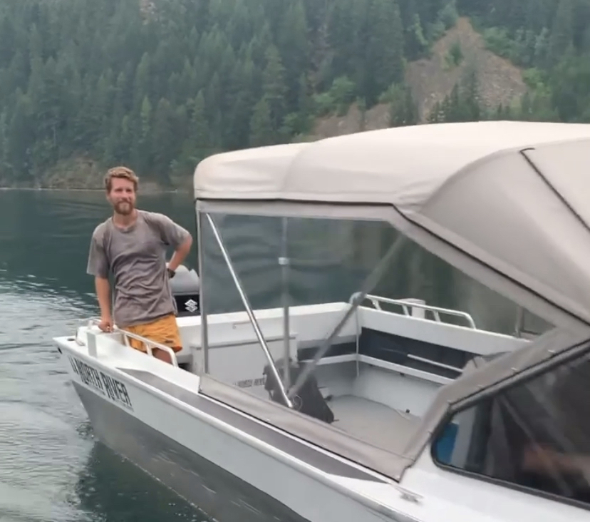
The next ten miles was a steep uphill climb pushing above tree line to pass over Devil’s Dome. I eventually began to descend but by this point it was late afternoon. The water taxi must have been long gone and I needed to get to the lake shore before dark if I had any chance of hitching a ride from a random boat. I devised a plan to take off my orange shorts, tie them to my trekking poles, and wave them like an SOS flag. This was now Option D for my exit strategy. Still thousands of feet above Ross Lake I could start to see the water fairly well. For some reason there were no boats on the water. The worry began to set in and I started to run the four miles down this last mountain. I made it to the dock and saw a boat untied, pushed off, and about to start its engine. Out of breath and energy I asked if he was the water taxi. He asked if I was Skyler and told me to hop in. The captain grabbed his radio and signaled the marina “I have the package”. If there was ever a moment that I felt like I was on the set of James Bond, Survivorman, or Behind Enemy Lines it was now. I gave sea legs a new meaning and took a seat on the back of this boat. I was safe. I was back to civilization. I was done walking. I took in the view, looking off in the distance at the mountains I had just conquered.

We pulled up to the marina and I was greeted with excited familiar faces of my family. I found myself speechless and could hardly utter any words. It was hard to talk about what just happened. In the end I was just confident in knowing there is always another backup plan and everything will work out.


Leave a comment